

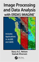
16 123 789 knih a 3 194 233 e-knih právě v nabídce
Osobní odběr zdarma
na 9 místech po celé České republice
na 9 místech po celé České republice
Doprava zdarma
při nákupu nad 1000 Kč
při nákupu nad 1000 Kč
Knihy z celého světa
226 220 816
Zavolejte nám:
Pondělí – pátek:
08.30 – 12.15
13.00 – 15.45
Odběr newsletteru
Mám zájem o slevy na tituly, poštovné zdarma a další zajímavé akce.



Dokumenty
- Nákupní řád
- Reklamační řád
- Podmínky zpřístupnění e-knih a audio souborů
- Politika integrovaného systému managementu
- Pravidla ochrany osobních údajů
- Ceníky ke stažení
- Informace o cookies
- Obchodní podmínky pro spotřebitele
- Obchodní podmínky pro školy
- Obchodní podmínky pro podnikatele, obchodní společnosti, státní instituce a organizační složky státu
- Etický kodex



© 2022 Megabooks CZ spol. s r.o. - zahraniční literatura. Výhradní distributor Oxford University Press
Všechny ceny jsou uvedeny s DPH
16 123 789 knih a 3 194 233 e-knih právě v nabídce
Osobní odběr zdarma
na 9 místech po celé České republice
na 9 místech po celé České republice
Doprava zdarma
při nákupu nad 1000 Kč
při nákupu nad 1000 Kč
Knihy z celého světa


Naše společnost
Dokumenty
- Nákupní řád
- Reklamační řád
- Podmínky zpřístupnění e-knih a audio souborů
- Politika integrovaného systému managementu
- Pravidla ochrany osobních údajů
- Ceníky ke stažení
- Informace o cookies
- Obchodní podmínky pro spotřebitele
- Obchodní podmínky pro školy
- Obchodní podmínky pro podnikatele, obchodní společnosti, státní instituce a organizační složky státu
- Etický kodex
Bookshopy
226 220 816
Zavolejte nám:
Pondělí – pátek:
08.30 – 12.15
13.00 – 15.45
Odběr newsletteru
Mám zájem o slevy na tituly, poštovné zdarma a další zajímavé akce.
© 2022 Megabooks CZ spol. s r.o. - zahraniční literatura. Výhradní distributor Oxford University Press
Všechny ceny jsou uvedeny s DPH